|
|||
|
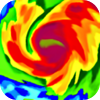
Simple yet powerful app for viewing real-time animated weather radar images in vivid color on a highly responsive interactive map, with higher resolution images than any other radar app in the appstore. Jaggies begone! Plus this is the only app that allows *you* to control the loop speed, and also choose the interval between individual frames from 5 minutes all the way to 30 minutes. Plus this is the only app that can show weather forecast, severe weather warning boxes, clickable storm direction arrows with details, clickable hurricane forecast tracks (including huge tropical storm Debby), and snowfall on the same map! Plus this is the only app that automatically augments land-based radar images with latest images from NOAA satellites covering the Atlantic/Pacific oceans into one single screen. This lets you track and follow the upcoming hurricanes and storms all from the same map. Plus easily bookmark multiple locations so you can do a quick radar + forecast check for all your important places in just a few seconds. ✓ Install and go, no complex setup ✓ Sharp images even on retina displays (when zoomed upto a certain point) ✓ Fast Loading ✓ Near real-time, shows the latest radar images within minutes of being gathered. ✓ Check the current weather + forecast for any point on the map ✓ Severe weather warning boxes on the map ✓ Storm Tracks on the map with detailed storm information ✓ Hurricane Forecast Tracks on the map ✓ Bookmark multiple locations for quick access ✓ Intuitive Play/pause/manual modes for moving between frames. ✓ Always shows both time-stamp and "minutes ago" with each frame to prevent any confusion while viewing the loop. ✓ Select opacity of radar images to your taste ✓ Read Area Forecast Discussions issued by your nearest NWS forecast office. ✓ Check your local radar site's hardware operational status from within the app ✓ See images from upto 4 hours ago by increasing frame interval to maximum ✓ Portrait/Landscape/FullScreen ✓ Get fast support from within the app Coverage Notes: If you live in a very-high-altitude town in Colorado (e.g. Fraser, Vail, Aspen), it is highly likely this app will not meet your needs since radar beams get blocked by the tall mountains. Alaska coverage includes only the southern coastal areas, and does not include the Aleutian Chain. Also cloud coverage does not include Alaska and Guam. Notes: ✓ This app is only useful for users in the US, including all 50 states and territories including Puerto Rico and Guam. © © 2011 GeoTerrestrial, Inc |
NOAA Hi-Def Radar – GeoTerrestrial, Inc
Subscribe to Applenews247.Com Newsletter